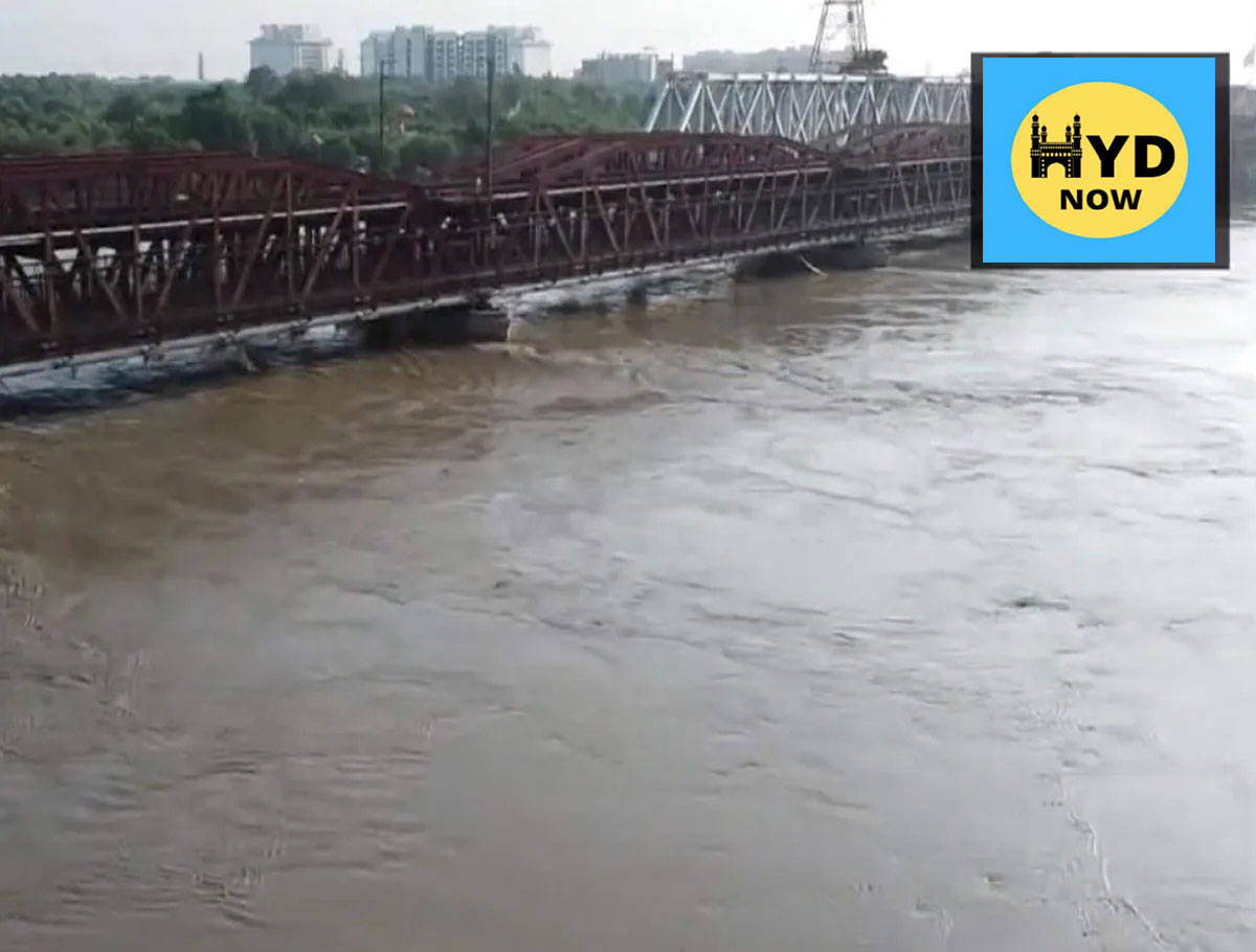
The water level of the Yamuna crossed the warning mark of 204.50 meters in Delhi following torrential rain in the river’s upper catchment areas over the past two days. According to the Central Water Commission’s website, the water level at the Old Railway Bridge rose from 203.48 meters at 3 pm on Monday to 204.94 meters at 6 pm on Tuesday.
The flow rate at the Hathnikund barrage in Haryana’s Yamunanagar district stood at 30,153 cusecs — considered moderate during the monsoon season.
An official of the Delhi government’s irrigation and flood control department said low-level flooding may occur at a few places along the river but a grave situation is unlikely.
At least 53 people have been killed in Himachal Pradesh as rain wreaked havoc in the hill state since Sunday.
Torrential rain also ravaged Uttarakhand over the past two days, destroying buildings and causing landslides that breached the national highways to Badrinath, Kedarnath, and Gangotri shrines.
Most of the rivers are overflowing due to the rain. The Ganga is flowing above the danger mark in Tehri, Haridwar, and Rishikesh. The Alaknanda and the Mandakini are flowing above the danger level in Rudraprayag, Srinagar, and Devprayag, the disaster control room in Uttarakhand’s Dehradun said.
In mid-July, Delhi faced unprecedented flooding due to heavy rainfall in the national capital and the Yamuna River’s upper catchment areas. The Yamuna swelled to a record 208.66 meters on July 13, breaching its previous record and penetrating deeper into the city than in more than four decades.
Over 27,000 people were evacuated during the floods with the losses incurred in terms of property, businesses, and earnings running up to crores of rupees.
The river flowed above the danger mark of 205.33 meters for eight days on the trot, starting July 10.
Experts attributed the flooding in Delhi to encroachment on the river’s floodplain, extreme rainfall within a short span of time, and silt accumulation that has raised the riverbed.
The Yamuna River system’s catchment covers parts of Uttar Pradesh, Uttarakhand, Himachal Pradesh, Haryana, Rajasthan, Madhya Pradesh, and Delhi.
The low-lying areas near the river in Delhi, inhabited by around 41,000 people, are considered prone to flooding. Encroachments on the river’s floodplain have occurred over the years, despite the land belonging to the Delhi Development Authority, the revenue department, and private individuals.
The city’s northeast, east, central, and southeast districts are most affected by floods in the city. A study on “Urban Flooding and its Management” by the Irrigation and flood control department identifies east Delhi under the floodplain region as highly vulnerable to floods.
Next Story:
-
MANUU Courses Admissions Open For Academic Year 2026-27
MANUU courses admissions open for 2026 with new M.Sc programmes and multiple courses across campuses. Apply before June 10.
-
No Change In Gold Prices In Hyderabad Today

The gold rates today stable in Hyderabad on 19 April, 2026. Going by the rates today, the price of 10 grams of 22-carat gold is Rs. 1,42,800 while the rate of 10 grams of 24-carat gold is at Rs 1,55,780.
-
Youth Commits Suicide Under suspicious circumstances

Suryapet / Hyderabad, April 18 (Maxim News): A young man died after hanging himself from a neem tree under suspicious circumstances on Saturday morning at Anantaram Adda Road in Penpahad Mandal of Suryapet district.
-
Private Bus Catches Fire In KPHB, Passengers Escape Unhurt

Hyderabad, April 18 (Maxim News) A major fire broke out in a private travel bus in the KPHB on Friday night, triggering panic among passengers. However, alert staff ensured that all 20 passengers were safely evacuated before the flames spread, averting a major tragedy.
-
Hyderabad: Father, 2-Year-Old Die in Road Accident

Hyderabad, April 15 (Maxim News): A horrific road accident took place on the Outer Ring Road in Hyderabad. A father and his two-and-a-half-year-old son died after being hit by a tanker that was watering trees.
Now you can get the latest stories from Hydnow every day. Click the link to subscribe. Click to follow Hydnow’s Facebook page and Twitter and Instagram